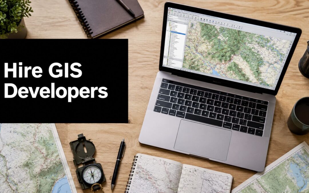
What are you hiring for when you say you need a GIS developer? The answer changes the vendor shortlist. A team rolling out ArcGIS Enterprise, building an open-source tiling pipeline, labeling LiDAR data, or training GeoAI models on imagery is buying very different capabilities, even if all four projects sit under the GIS label.
That distinction matters because GIS work has moved beyond map production into system integration, cloud delivery, data engineering, and applied AI. Buyers who start with a generic role title often get a weak match on architecture, tooling, or delivery model. For teams that are still framing the problem, this overview of the benefits of geospatial information is useful background. For teams already planning delivery, the better question is which specialty reduces project risk.
Hiring strategy follows scope. If you need a broader framework for evaluating technical partners, this guide on how to recruit software developers is a helpful reference. The same logic applies here. A strong Esri implementation partner, an open-source geospatial engineering shop, and a GeoAI-focused services firm can all look plausible in procurement, yet they solve different problems and carry different trade-offs.
That is also why firms that combine geospatial work with data and AI services deserve separate consideration. Teams focused on imagery analysis, remote sensing, or spatial ML may need support beyond GIS engineering alone, especially when data preparation is part of the bottleneck. In those cases, evaluating a partner's process for vetting AI engineering talent can matter as much as its mapping credentials.
This list is organized by specialty rather than brand visibility. The goal is to help you compare where each firm fits best, where it may be less suitable, and how to choose a partner based on project requirements instead of marketing language.
1. Zilo AI | Hire AI Experts, ASR Engineers, NLP & Data Talent in India

Zilo AI stands out because it doesn't treat GIS talent as a standalone hiring category. It treats geospatial work as part of a broader AI and data-production pipeline. That's a better fit for teams building computer vision, remote sensing, LiDAR, or multilingual spatial products than the usual staffing vendor that just forwards resumes.
Its value is the combination. You can source specialists with GIS and LiDAR exposure, but you can also pair them with annotation, transcription, translation, and linguistic services that help turn raw data into model-ready assets. For geospatial AI work, that's often the missing layer between “we have imagery” and “we have a usable product.”
For teams trying to vet AI engineering talent, that combination solves a practical problem. You don't need one vendor for staffing, another for labeling, and a third for language work if the project spans geospatial imagery, speech, or multilingual data.
Best fit
Zilo AI makes the most sense when your GIS requirement overlaps with AI operations or data preparation. That includes map feature extraction, geospatial imagery review, LiDAR-supported workflows, and any product where location data has to be structured before developers can build on top of it.
The firm is also a strong option when you need flexible resourcing instead of a fixed implementation package. Some buyers need a single GIS-aligned engineer. Others need a pod that combines domain experts and data workers. Zilo can support both models, which is more useful than a rigid “project only” arrangement.
A related read on scaling technical teams is Zilo's guide on how to recruit software developer talent effectively.
Trade-offs to weigh
Zilo AI isn't the obvious choice if you want one firm to own a full enterprise GIS transformation from architecture through managed services. Its center of gravity is talent plus data services, not a productized ArcGIS rollout or a fully managed MLOps platform.
Potential buyers should also think through operating model questions early.
- Time zone planning: India-based delivery can be a strength for throughput, but teams with heavy real-time collaboration needs should define overlap hours upfront.
- Scope clarity: Zilo is strongest when the work is tied to specialist staffing, annotation, and AI-ready data operations. If you need a large systems integrator, you'll likely pair it with another partner.
- Specialist advantage: If your bottleneck is niche geospatial or LiDAR expertise, Zilo is more targeted than generalist staffing firms.
For organizations that want to hire GIS developers without building every capability in-house, Zilo AI is one of the few options that bridges talent acquisition and data readiness in the same engagement.
Direct site: Zilo AI
2. Blue Raster

What if your GIS project is less about writing spatial code and more about making ArcGIS, cloud infrastructure, security, and stakeholder workflows work together without failure?
Blue Raster belongs in the Esri-centric category of this list. That matters because buyers looking to hire GIS developers often compare firms as if all geospatial vendors solve the same problem. They do not. Blue Raster is strongest where ArcGIS is already the operating standard and the primary risk lies in deployment, governance, usability, and long-term support.
Its profile fits agencies, transportation teams, utilities, and enterprise programs that need more than a map interface. Blue Raster combines ArcGIS implementation with application design, accessibility work, cloud integration, and managed services. For organizations with public-facing systems or regulated environments, that mix can matter more than raw coding capacity.
The hiring angle is also different here. If you need individual contributors, lists of best AI staffing agencies or broader guides to top IT staffing agencies in the USA can help benchmark talent models. Blue Raster is usually the better fit when the problem is program delivery. It works best for teams that want a partner to own architecture decisions, application rollout, user adoption, and support within an Esri environment.
Where Blue Raster fits best
Blue Raster makes the most sense when ArcGIS Enterprise or ArcGIS Online is central to the roadmap and the project carries institutional complexity. Examples include operational dashboards for state agencies, field workflows for utilities, or spatial applications that need to meet accessibility and security requirements. In those cases, a specialist firm with repeatable Esri delivery patterns can reduce implementation risk.
It is less differentiated for a lightweight product build. If the goal is to ship a fast MVP, test a location feature, or keep the stack vendor-neutral, some buyers will get more flexibility from an open-source shop or a product engineering team.
Practical rule: Choose Blue Raster when the hard part is integrating GIS into enterprise operations, not simply adding maps to software.
Trade-offs
The trade-off is straightforward. Blue Raster's strengths are tied closely to Esri and enterprise delivery. That usually means more process, more governance, and pricing that reflects higher-touch implementation.
That focus can be an advantage or a constraint. If your organization has already committed to ArcGIS and needs a dependable delivery partner, Blue Raster is one of the safer options in this category. If your longer-term plan centers on PostGIS, GeoServer, or a heavily customized open-source stack, its fit is narrower.
Direct site: Blue Raster
3. Sparkgeo

What if your GIS partner needs to act less like a systems integrator and more like a product engineering team with spatial depth? That is the case for Sparkgeo.
Within this list, Sparkgeo fits the product-focused category. Its work is most relevant when location is one layer of a larger software product, such as a geospatial API, an imagery workflow, a map performance problem, or a spatial feature inside logistics, retail, climate, or analytics software. Buyers evaluating firms by specialty, rather than brand recognition alone, should read Sparkgeo as a strong option for cloud-first application development rather than enterprise GIS rollout.
That distinction matters. Some GIS firms are optimized for long procurement cycles, formal platform rollouts, and large institutional deployments. Sparkgeo is a better fit for teams that need senior technical judgment during product buildout, especially where geospatial infrastructure, web engineering, and data pipelines intersect.
Where Sparkgeo fits best
Sparkgeo is strongest when the hard problem is technical integration inside a software product. Examples include building services on top of cloud geospatial data, improving tile or rendering performance, designing location-enabled APIs, or adding spatial analysis to an existing application without restructuring the full stack around GIS.
This makes Sparkgeo relevant for product companies, innovation teams, and organizations building new digital services. It can also suit buyers that need specialized geospatial developers but do not want the search process of a broad staffing marketplace. For teams comparing broader hiring models, this guide to top IT staffing agencies in the USA provides useful context on how specialist firms differ from general talent suppliers.
A practical way to frame Sparkgeo is this: choose it when software delivery speed, architecture quality, and spatial engineering matter more than platform standardization.
Trade-offs
The trade-off is scale. Sparkgeo's boutique profile can be an advantage if you want experienced contributors and direct collaboration with a small team. It can be a constraint if you need a large bench, 24/7 support structure, or rapid staffing across several workstreams at once.
Its fit is also narrower in heavily regulated or procurement-heavy environments. Buyers centered on ArcGIS standardization, on-prem modernization, or large public-sector implementations may find a more specialized Esri partner easier to align with internal requirements.
- Best for: product teams, cloud-native geospatial applications, API development, imagery and data pipeline work
- Less ideal for: large enterprise rollouts, public-sector procurement-led projects, legacy on-prem GIS programs
Direct site: Sparkgeo
4. Development Seed

What if your GIS project is really a data infrastructure project in disguise?
That framing helps explain where Development Seed stands out. Among firms in this list, it is one of the clearest open-source specialists. Its work aligns best with buyers that need cloud-native geospatial systems, standards-based data access, dynamic tiling, and production workflows around imagery and Earth observation data.
This is a different category from Esri administration or general GIS implementation. Development Seed is strongest when the project requires custom engineering around STAC, APIs, raster processing, and web delivery at scale. For teams building products or public data platforms, that specialty can matter more than a large consulting bench.
Best use cases
Development Seed fits organizations that treat GIS as part of a broader data platform. That includes EO startups, research programs, climate and environmental initiatives, public-interest technology teams, and agencies publishing large geospatial datasets for external use.
As noted earlier, the market is shifting toward cloud-based GIS and integration-heavy work. Development Seed matches that shift well because it builds vendor-neutral systems that connect storage, processing, APIs, and front-end applications. Teams assessing the operational side of that stack may also want to review this guide on building a scalable data pipeline for analytics and applications.
The more interesting distinction is strategic. Open-source GIS is not only a licensing decision. It also affects architecture control, hiring needs, and long-term portability. Development Seed tends to be a stronger fit for buyers that want ownership of their technical stack rather than dependency on a single platform roadmap.
Trade-offs
That strength comes with clear trade-offs. If your environment is heavily ArcGIS-based and the main goal is configuration, enterprise administration, or extending existing Esri workflows, another partner may be more efficient. Development Seed usually adds the most value when custom cloud engineering is central to the brief.
It also fits best with technically mature clients. Buyers with internal engineering capacity often get more from this model because they can make informed choices about infrastructure, open standards, and long-term maintenance. Teams looking for a conventional systems integrator with a packaged delivery model may find the engagement style less familiar.
- Best for: open-source geospatial stacks, Earth observation platforms, raster tiling and APIs, cloud-native spatial data systems
- Less ideal for: ArcGIS-centric environments, configuration-led GIS projects, buyers that need a large integrator or heavy procurement support
Direct site: Development Seed
5. Element 84

What if your GIS project is less about web maps and more about turning satellite data, scientific models, or imagery pipelines into production software? That is the niche where Element 84 stands out.
Within this list, Element 84 fits the Earth observation and scientific engineering category. Its profile is different from an Esri-focused implementation partner or a general GIS development shop. The firm is best understood as a geospatial software company for teams working with remote sensing, cloud infrastructure, APIs, and analysis workflows that need to hold up in real operational settings.
That specialization matters because EO projects often fail at the handoff between research and delivery. A prototype may work on a sample dataset, yet break once data volumes grow, model assumptions change, or multiple systems need to integrate. Element 84 appears strongest in that transition from technical experiment to maintainable software.
Where Element 84 fits best
Element 84 is a strong match for agencies, environmental programs, and research-driven organizations that need custom systems around imagery or spatial data, not just GIS app configuration. Common use cases include EO processing pipelines, geospatial APIs, cloud-based data services, and imagery-centered ML or computer vision work.
Compared with firms on this list that center their offer on ArcGIS administration or packaged enterprise GIS services, Element 84 is more likely to be the better choice when the hard part is engineering. Compared with open-source map platform specialists, it also looks more oriented toward scientific and operational data products built around remote sensing workloads.
Trade-offs
The same focus narrows the ideal buyer profile. Element 84 is usually a better fit for projects with meaningful technical complexity, clear product or platform goals, and stakeholders who can support a more engineering-heavy engagement model.
If your need is a straightforward departmental GIS rollout, light web mapping, or routine Esri configuration, another firm may reach the outcome faster and with less overhead. Buyers should also expect a partner optimized for specialized delivery rather than low-cost task execution.
- Best for: Earth observation systems, scientific software, cloud-based imagery pipelines, geospatial APIs, ML workflows on raster and sensor data
- Less ideal for: simple GIS app builds, configuration-led ArcGIS projects, small one-off departmental requests
Direct site: Element 84
6. GEO Jobe

What if the hard part of your GIS project is not building another app, but keeping an ArcGIS estate clean, stable, and governable over time? GEO Jobe stands out in that narrower category.
Among the firms in this list, GEO Jobe is one of the clearest Esri-centric choices. Its differentiation is not only custom development. It also sells productized tools for ArcGIS administration, including Admin Tools, Backup My Org, and Clean My Org. That combination matters for buyers whose costs come from user provisioning, content sprawl, backup discipline, and ongoing platform support rather than from novel spatial engineering.
Where GEO Jobe works best
GEO Jobe fits organizations that have already committed to ArcGIS Online or ArcGIS Enterprise and want a partner that can both configure and maintain that environment. Typical use cases include Experience Builder delivery, ArcGIS JavaScript work, mobile apps tied to Esri workflows, org cleanup, and managed support after launch.
This makes GEO Jobe meaningfully different from firms in this article that skew toward open-source platforms, GeoAI, or scientific data systems. If your program depends on Esri governance and operational reliability, those adjacent strengths may be less relevant than repeatable administration and support.
There is also a hiring-market angle here. As noted earlier, advanced GIS developer and administrator skill sets are harder to hire than general GIS execution. For teams struggling to recruit ArcGIS admins with enough depth in security, content structure, and platform operations, GEO Jobe can be a practical substitute for building that capability in-house.
Trade-offs
The trade-off is focus. GEO Jobe is a stronger option when Esri is a settled decision than when platform choice is still open.
Buyers who need a vendor-neutral architecture, heavy open-source geospatial infrastructure, or highly custom data engineering may find the firm too aligned with the ArcGIS stack. That does not make GEO Jobe weaker. It makes the fit narrower, which is often a good thing if your project risk sits in ArcGIS administration rather than experimental engineering.
- Best for: ArcGIS Online and Enterprise administration, Experience Builder projects, Esri-centered app development, org cleanup, managed support
- Less ideal for: open-source-first architectures, vendor-neutral platform strategy, geospatial engineering centered on custom data pipelines
Direct site: GEO Jobe
7. Locana (now part of TRC Companies)

Locana is the “large-program” choice for buyers who need GIS strategy, implementation, and integration depth across disciplines. Its backing from TRC Companies makes it especially relevant when geospatial work sits inside a bigger engineering, infrastructure, utility, or digital-transformation program.
That scale can be a real advantage. Some projects don't just need GIS developers. They need GIS, cloud, enterprise integration, domain consulting, and the ability to coordinate across many stakeholders at once.
Best fit
Locana is well suited for enterprise and public-sector programs with long timelines, multiple systems, and cross-functional governance. It also makes sense when your architecture can't be purely Esri or purely OSS because business reality forces a hybrid.
A useful market lens comes from a GIS salary and skills discussion on YouTube, which argues that developer-tier GIS roles increasingly center on SQL, Python, and cloud-oriented engineering rather than traditional tools alone. Locana's cross-platform positioning maps well to that shift because it operates above the level of pure software preference. It is built for integration and rollout.
Trade-offs
The downside is process. Large organizations often bring heavier governance, more formal delivery motions, and a stronger preference for substantial budgets and longer engagements.
- Choose Locana for: enterprise modernization, utility and infrastructure programs, hybrid stack integration
- Avoid Locana for: lightweight prototypes, experimental R&D, very small budgets
For the right buyer, that trade-off is acceptable. Big, messy GIS programs rarely fail because there wasn't enough technical talent. They fail because no one could orchestrate all the moving parts.
Direct site: Locana
8. Woolpert

Woolpert belongs in a different category from software boutiques. It's a large geospatial and AEC firm with the ability to handle data acquisition, sensors, imagery, enterprise GIS, and custom applications under one roof. That breadth matters when software is only one layer of the job.
A lot of GIS buying decisions ignore this. If your challenge involves field capture, imagery programs, transportation assets, utilities, or nationwide coordination, the best “developer partner” may be a firm that can connect software to operational data collection.
Why Woolpert can be the safer choice
Woolpert is strongest in sectors where domain context matters as much as code quality. Utilities, transportation, and government teams often need a partner that understands not just spatial software, but also asset workflows, compliance, and large-area deployment realities.
That aligns with a broader market mismatch highlighted in a recent GIS hiring discussion on YouTube, which argues that employers increasingly need cloud-native GIS and automation skills but still frame recruitment around older credential filters. Firms like Woolpert can bridge that gap because they don't approach GIS as a low-technical support function. They treat it as part of a larger engineering delivery model.
Trade-offs
Woolpert probably isn't the right call for a startup building a narrow location feature or an internal team trying to validate a small product concept quickly. Large-firm processes can slow decision-making.
Still, there are cases where that process is a feature, not a bug.
Large multi-jurisdiction GIS programs often need discipline more than speed. Woolpert is built for that kind of work.
If your priority is scope control across software, imagery, and operations, Woolpert is a serious contender.
Direct site: Woolpert
9. AppGeo (Applied Geographics)

Need a GIS partner that can modernize public systems without forcing a full platform reset? AppGeo earns its place on this list because it sits in a useful middle category: firms that know the Esri world well, but can also work in hybrid environments where open-source tools, legacy databases, and hosted deployments all need to coexist.
That specialty matters for agencies with accumulated technical debt. State and local teams often inherit ArcGIS investments, custom integrations, procurement constraints, and uneven internal engineering capacity. In that setting, the best partner is rarely the one with the flashiest R&D profile. It is the one that can migrate carefully, keep services running, and reduce architectural risk during the transition.
Where AppGeo fits
AppGeo looks strongest in government modernization programs, regulated organizations, and teams that need a stable delivery partner for hosting, upgrades, and platform transitions. Compared with firms on this list that skew toward frontier GeoAI or open-source infrastructure, AppGeo appears better suited to buyers who need practical execution inside mixed environments.
Its value is less about novelty and more about fit. As noted earlier in the article, GIS hiring increasingly blends classic ArcGIS skills with Python, cloud workflows, and open-source geoprocessing. A firm that can handle both established enterprise GIS and gradual modernization is often a better choice for public-sector work than a pure-stack specialist.
Trade-offs
The trade-off is focus. AppGeo may be less compelling for buyers seeking experimental computer vision, highly custom product engineering, or contribution-level open-source platform work. Those needs usually point to a narrower specialist.
For agencies and regulated teams, though, AppGeo's steadiness can be an advantage rather than a limitation.
- Best for: government GIS modernization, managed or hosted deployments, migration projects, hybrid Esri and OSS environments
- Less ideal for: GeoAI-heavy builds, startup-style product development, highly experimental geospatial engineering
Direct site: AppGeo
10. GeoSolutions USA

What if your GIS project succeeds or fails less on app features and more on whether the underlying services follow open standards, scale cleanly, and remain maintainable without locking you into one vendor?
GeoSolutions USA stands out in that narrower category. On this list, it is one of the clearest fits for buyers building around open-source geospatial infrastructure rather than primarily buying front-end app development or ArcGIS administration. If your roadmap includes GeoServer, GeoNode, GeoNetwork, or MapStore, the firm's specialization is easier to evaluate than a general "full-service GIS" label suggests.
Its appeal comes from depth of involvement in core OSS geospatial projects and standards-based systems. For buyers that need OGC and ISO compliance, production-grade geospatial services, or support for interoperable data infrastructure, that matters more than a long generic services menu. A firm close to the underlying tooling is often better positioned to handle performance tuning, integration issues, and long-term maintenance than a broader consultancy that treats open-source GIS as one option among many.
Where GeoSolutions USA fits
GeoSolutions USA looks strongest for agencies, utilities, environmental platforms, and enterprise teams that want to control their stack, avoid unnecessary licensing dependence, and run standards-based geospatial services in production. It is also a strong candidate when the true hiring need is platform engineering. As noted earlier in the article, many GIS hiring needs are software, data infrastructure, and interoperability problems framed as mapping work.
That distinction changes the vendor shortlist.
Compared with Esri-centered firms in this roundup, GeoSolutions USA is a better match for buyers who prioritize open architecture and standards compliance over tight alignment with the ArcGIS ecosystem. Compared with cloud-native product studios, it appears more infrastructure-focused and less oriented toward polished customer-facing application builds.
Trade-offs
The trade-off is specialization. Teams that are firmly committed to ArcGIS, need heavy Esri configuration work, or want a partner centered on rapid product UX may find a better fit elsewhere.
Buyers should also expect a more technical engagement model. Open-source geospatial infrastructure projects usually require clearer architectural decisions up front, especially around hosting, integrations, security, and support ownership.
Direct site: GeoSolutions USA
Top 10 GIS Developer Hiring Firms Comparison
| Provider | Core offering | Unique strength (✨) | Target audience (👥) | Quality (★) | Price/Value (💰) |
|---|---|---|---|---|---|
| Zilo AI 🏆 | AI manpower + data services (text/image/voice annotation, translation, transcription, GIS/LiDAR talent) | ✨ Integrated staffing + AI-ready datasets; multilingual linguistic expertise | 👥 AI teams, ML/vision, ASR/NLP projects needing rapid staffing & data | ★★★★☆ | 💰 $ (competitive for combined staffing + data) |
| Blue Raster | Full‑stack Esri GIS apps, ArcGIS Enterprise, cloud & GeoAI | ✨ Enterprise Esri Gold/Platinum partner; strong UI/UX & security | 👥 Large government, DOTs, enterprises on Esri | ★★★★★ | 💰 $$ (premium enterprise pricing) |
| Sparkgeo | Geospatial consulting, product dev, imagery pipelines, APIs | ✨ Modern cloud architectures; remote-first embedded teams | 👥 Startups & enterprises building location-enabled products | ★★★★☆ | 💰 $–$$ (boutique product focus) |
| Development Seed | OSS geospatial engineering, cloud-native pipelines, DevOps | ✨ Strong OSS/STAC pedigree; planetary-scale imagery performance | 👥 EO, research orgs, data-heavy startups | ★★★★★ | 💰 $$ (specialized cloud/scale work) |
| Element 84 | Cloud EO processing, ML/vision workflows, R&D → production | ✨ Blend of R&D and production for federal & scientific programs | 👥 Federal agencies, scientific programs, EO teams | ★★★★☆ | 💰 $$ (multi-month, high-value engagements) |
| GEO Jobe | Esri extensions, ArcGIS admin tools, GeoAI, UAV workflows | ✨ Productized ArcGIS tools + 24/7 US support | 👥 Organizations standardized on Esri needing ops tools | ★★★★ | 💰 $–$$ (value via accelerators) |
| Locana (TRC) | Enterprise GIS strategy, cross‑platform cloud, AI/GeoAI | ✨ Backed by TRC for scale and multidisciplinary staffing | 👥 Large-scale, multidisciplinary enterprise programs | ★★★★ | 💰 $$ (enterprise scale engagements) |
| Woolpert | Enterprise GIS, imagery & sensor programs, sector solutions | ✨ Deep domain expertise (utilities, transportation, gov) | 👥 Multi-state/nationwide public‑sector & AEC clients | ★★★★ | 💰 $$ (large-firm procurement model) |
| AppGeo (Applied Geographics) | GIS strategy, hosting, migrations, OSS/Esri hybrids | ✨ Public‑sector experience & hosted modernization templates | 👥 State/local government, public‑sector agencies | ★★★★ | 💰 $ (government-focused value) |
| GeoSolutions USA | Enterprise OSS geo platforms (GeoServer, GeoNode, MapStore) | ✨ Core OSS contributors; standards‑compliant enterprise support | 👥 Teams avoiding vendor lock‑in; OSS-first orgs | ★★★★ | 💰 $ (subscription + support model) |
How to Choose the Right GIS Development Partner
The biggest mistake buyers make when they hire GIS developers is comparing firms as if they all solve the same problem. They don't. Blue Raster and GEO Jobe are strong choices if you're standardizing on Esri and need dependable enterprise execution. Development Seed and GeoSolutions USA are better fits if you care most about open-source architecture, standards, and long-term control of the stack. Sparkgeo is closer to a product engineering partner. Woolpert and Locana make more sense when GIS sits inside a much larger infrastructure or enterprise program. Zilo AI becomes especially compelling when geospatial work intersects with AI staffing, data labeling, LiDAR, or multilingual data operations.
Start with the technical center of gravity. If your program lives in ArcGIS Enterprise, don't force an OSS-first firm into that role. If your goal is vendor neutrality, don't choose a partner whose advantages depend on deeper Esri lock-in. This sounds obvious, but many failed engagements begin with a mismatch between platform strategy and partner DNA.
Then define whether you're buying execution capacity, architecture judgment, or both. Some firms are excellent at delivering against a defined roadmap. Others are more valuable earlier, when the roadmap itself is still fuzzy. That's an important distinction. A team building an Earth observation platform needs different help than a county agency migrating legacy services or a utility rolling out field applications.
Budget and timeline matter, but they shouldn't be your first filter. In GIS, low upfront cost often hides downstream integration pain. The salary data in the market also points in the same direction: developer and cloud-oriented GIS work commands a premium because the skill mix is hard to assemble and expensive to replace once a project goes sideways. In many cases, the better decision is to pay for fit rather than save money on a partner who needs months to understand your stack.
When you vet firms, ask questions that expose delivery reality.
- Meet the actual team: Don't stop at the sales lead. Ask who will build, manage, and review the work.
- Check stack fluency: Ask which tools they use day to day. Look for specifics such as ArcGIS Enterprise, Experience Builder, PostGIS, GeoServer, STAC, GeoPandas, rasterio, AWS, or Azure.
- Probe integration history: A polished demo matters less than evidence they can connect spatial systems to cloud, business data, security, and operations.
- Test for domain understanding: Utilities, transportation, EO, local government, and logistics all use GIS differently. Domain ramp time is real.
- Clarify post-launch support: Some firms are optimized for build-and-hand-off. Others are structured for long-term support and managed services.
A final rule is simple. Choose the partner whose strengths align with your bottleneck. If your bottleneck is data readiness, a talent-plus-data-services partner like Zilo AI may outperform a conventional GIS consultancy. If your bottleneck is enterprise ArcGIS governance, pick an Esri specialist. If your bottleneck is cloud-native geospatial infrastructure, choose an OSS or EO-focused engineering shop.
The right GIS development partner doesn't just fill a skills gap. It reduces architecture risk, shortens decision cycles, and gives your team a more realistic path from spatial data to production outcomes.
If you need to scale geospatial, AI, LiDAR, or multilingual data work without stitching together multiple vendors, Zilo AI is worth a close look. Its mix of specialist staffing and AI-ready data services gives teams a practical way to hire GIS developers, support annotation-heavy workflows, and move from raw data to usable delivery faster.