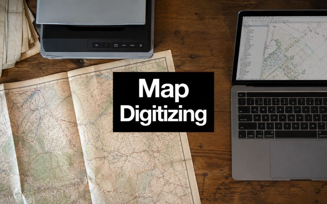
Stacks of paper maps, fragile aerial film, and legacy drawings tend to sit in the same category until a project suddenly depends on them. Then they become urgent, because one badly handled scan, one weak georeference, or one sloppy vector extraction can ripple through permits, asset inventories, and operational dashboards. That's why map digitizing services matter, not as a scanning convenience, but as the bridge from analog records to GIS-ready data that teams can use. For readers who need adjacent spatial data context for product planning or proptech workflows, this geospatial data for proptech teams resource is a useful side reference.
The best buyers don't start by asking who can “digitize a map.” They ask who can preserve the original, align it correctly, validate the output, and deliver something that fits the downstream system without extra cleanup. The difference shows up fast in historical archives, utility asset mapping, parcel work, and infrastructure-gap analysis, where the value is in the workflow as much as the image. Some providers are built for archival scanning and hosting, others for land records, others for AI-assisted extraction, and the right choice depends on what you need the data to do after capture.
1. East View Geospatial

East View Geospatial fits projects where preservation and accuracy matter at the same time. The company handles wide-format scanning, georeferencing, mosaicking, and head-up vector extraction, which means the original cartographic intent can survive the conversion instead of getting flattened into generic geometry. For large institutional archives, that matters more than flashy automation, because the source materials are often fragile, inconsistent, and too important to risk on a fast but careless workflow.
A practical advantage is the optional MapVault hosting and streaming layer, which can simplify access after delivery. That matters for libraries, agencies, and collections teams that need both preservation-grade capture and a way to distribute outputs without building a custom portal.
Practical rule: choose EVG when the source material is the asset, not just the input.
What stands out
- Preservation-grade capture: Wide-format scanning and OCR for large, delicate collections.
- Alignment discipline: Georeferencing built around reliable control-point standards.
- Clean delivery options: GeoTIFF and GeoPDF outputs are useful for GIS and review workflows.
- Archival access: MapVault can reduce internal overhead after digitization.
Trade-off
- The company's enterprise orientation can mean longer procurement cycles, and pricing is typically custom. That's normal for archival-scale work, but it can slow smaller teams that want a quick quote and a quick turn.
For teams building a broader GIS program, this kind of archival handling pairs well with an internal workflow grounded in geospatial data services, especially when the end goal is searchable, reusable spatial data rather than just a file repository.
2. NV5 Geospatial
NV5 Geospatial fits better when digitization has to hold up inside a documented, auditable production system. Its service lines include Data Creation: Digitization and Data Conversion, which is a practical sign that the work is built for repeatability, traceability, and controlled handoffs. For agencies and enterprises, that matters because the risk is not just a bad file, it is losing track of how the file was made, reviewed, and passed downstream.
The firm also makes sense when digitization sits inside a broader modernization program. If a mapping effort also touches AI or GeoAI, the digitization step cannot live off to the side as a one-off vendor task. It has to connect cleanly to QA, metadata, and later analysis, or teams end up spending time cleaning up the same data in different places.
That is where NV5 tends to fit.
Best use cases
- Programmatic public-sector work: Suited to federal and state environments where documentation and process control matter.
- Large production runs: Better for multi-agency efforts and other jobs that need a repeatable workflow.
- Mixed-format conversions: Useful when raster and vector assets need to be brought into the same GIS environment.
- Audit-sensitive projects: A stronger choice when procurement teams want visibility into how the work was handled.
NV5 makes the most sense when the deliverable has to survive review, not just upload.
Watch-outs
- Smaller jobs may not be a natural fit, because enterprise minimums and lead times can be more realistic than a quick quote.
- If you need highly specialized cartographic artistry or very specific archival treatment, scope definition has to be tight from the start.
The market size helps explain why this kind of structure keeps showing up. One major market study estimates the digital map market at USD 18.18 billion in 2022 and projects USD 54.98 billion by 2030, a 15.8% CAGR from 2023 to 2030, while another forecast places it at USD 31.24 billion in 2025 and USD 49.73 billion by 2030, implying a 9.7% CAGR over that period. Grand View Research points to that scale, and it helps explain why enterprise-grade digitization workflows keep expanding.
3. Woolpert

Woolpert has long been the kind of provider agencies call when legacy aerial film and old map series need to become usable GIS inputs. The company's strengths are in historic aerial and film scanning, georeferencing, control, and rectification, with cloud-based delivery options that make downstream sharing easier. That combination is especially valuable when the work is less about producing a pretty digital artifact and more about creating a dependable basemap or derivative dataset.
The firm's track record with state DOTs and local governments gives it credibility in environments where QC and continuity matter. Public agencies don't just need files, they need outputs they can trust in planning, asset management, and recordkeeping.
For teams working with dense 3D or survey-adjacent workflows, the same discipline that makes aerial conversion reliable often shows up in broader geospatial modernization, including 3D LiDAR point cloud use cases that depend on clean alignment and structured delivery.
Why buyers pick Woolpert
- Legacy media expertise: Strong on aerial film and historical source conversion.
- Government fluency: Familiar with state and local public-sector expectations.
- Quality control: Better suited to projects where rectification standards matter.
- Delivery flexibility: Cloud options help when multiple staff need access.
Where it's less ideal
- The emphasis often leans toward aerial and remote sensing rather than pure cartographic vector extraction.
- Small ad hoc jobs may not always be the best fit, because the service model is often geared toward programmatic work.
Woolpert's value is in reducing the risk that old imagery becomes a modern liability. If the source set is large, sensitive, and operationally important, that's the right trade-off.
4. LAND INFO
LAND INFO is straightforward in the best sense. The company focuses on large-format scanning and georeferencing, which makes it useful for agencies and engineering teams that want legacy paper map sets converted into GIS-ready outputs without a lot of drama. That clarity matters when the project is time-bound and the source material is mostly standard topographic or technical sheets.
The practical upside is speed. If your team has boxes of paper maps and a coordinate reference system to target, LAND INFO's service menu is easier to scope than a broader consulting engagement. That can shorten procurement and reduce the back-and-forth that often slows simpler jobs.
Good fit when
- Large-format documents: Topographic maps, technical drawings, and similar materials.
- Standardized outputs: GeoTIFF and GeoPDF deliverables are enough for many users.
- Legacy map batches: Fast turnarounds matter more than exotic processing.
- Government and engineering work: The workflow aligns well with public-sector and project-based needs.
Potential limitation
- The offering is strongest at scanning plus georeferencing. If you need complex vector extraction or layered attribution, you may need separate scoping or a second vendor.
The cheapest digitization job is the one that doesn't create rework later.
The buyer's question here is simple. If the project is mostly about making a map legible, aligned, and shareable, LAND INFO is a practical option. If the project needs feature extraction, advanced attribution, or multi-stage QA, the scope should be written with more precision.
5. GeoDyn

GeoDyn is built for historical aerial imagery backlogs, and that specialization shows. Its workflow centers on high-speed film scanning, georeferencing, position determination, and QA, with temporal layer creation for change analysis. If the material is old film rather than paper maps, that focus can save a lot of internal effort.
This kind of service becomes especially valuable when a team needs multiple time slices for analysis. A single clean scan is useful, but a set of aligned temporal layers is what lets GIS analysts compare change over time without wrestling the source media every time they open the project.
Why it stands out
- Throughput: Strong for large historical imagery backlogs.
- Historical imagery focus: Purpose-built for film conversion rather than generic scanning.
- Change analysis support: Temporal layers are helpful for planning and research.
- Quality control: Georeferencing and QA are part of the core value, not an afterthought.
What to consider
- The imagery-first model means pure cartographic vector extraction may need add-on services.
- Pricing is custom and will depend on reel count and target accuracy, so scoping needs to be specific.
The broader market is shifting toward fine-scale intelligence, not just archiving. In broadband and service-access mapping, a 2025 study used terrain ruggedness, population density, road infrastructure, and utility corridors to build high-resolution accessibility maps for unserved and underserved zones, showing how digitized spatial data feeds decision-making beyond basic conversion, according to WJARR's 2025 paper. GeoDyn sits close to that kind of analysis-ready workflow.
6. USLandGrid
USLandGrid is the most domain-specific option in this list, and that's a strength if you work with parcels, land records, or right-of-way files. The company digitizes hard-copy maps, plats, and related land records into precise, attributed vector datasets, which is exactly what many oil and gas, utilities, and local government workflows need. In those projects, generic digitization is usually not enough, because the deliverable has to support permitting, lease management, and property operations.
The most useful thing about a land-records specialist is judgment. Parcel work is full of little assumptions about boundaries, labels, and attribution, and a vendor that understands land grids tends to produce output that's easier to defend internally.
Strong fit for
- Parcel and plat rectification: Good when paper records need to become usable vectors.
- ROW and lease mapping: Helpful for rights-of-way and field operations.
- GIS/CAD conversion: Useful for teams bridging land records and engineering systems.
- Attributed outputs: Better when the map is only useful if the attributes are trustworthy.
Limitations
- The thematic scope is narrower than a general geospatial bureau.
- Projects outside land and ROW can require extra consultation, which is fine if you plan for it but frustrating if you don't.
For parcel workflows, the real risk isn't the scan, it's the attribute mismatch.
If you're buying for utility expansion or land management, this is the type of provider that understands how digitized linework becomes a working record rather than a pretty overlay.
7. Historical Information Gatherers

Historical Information Gatherers is a strong pick for fragile, archival-grade work. The company uses proprietary large-format equipment to digitize maps, aerial photography, and other sensitive records, then extends that work into georeferencing and GIS/database services. That makes it more than a scanning shop, because the output can become a searchable collection rather than a pile of images.
The strongest use case is a municipal or archival environment where the records are unique and the handling requirements are strict. If originals are fragile, the provider needs to respect preservation constraints while still producing something modern users can search and analyze.
Why it works
- Sensitive media handling: Better for fragile historical materials.
- End-to-end path: Scan, georeference, and database conversion in one service chain.
- Archival context: Useful for municipalities, museums, and historical collections.
- Custom fit: Project scoping can be customized to the collection.
For organizations that need a broader archival workflow, this type of service pairs naturally with document-heavy programs where OCR and metadata matter, similar to the problems discussed in OCR applications.
Trade-off
- Boutique capacity can mean longer lead times for very large backlogs.
- Pricing is usually custom, so the budget conversation should happen after material review, not before.
This is the sort of vendor you bring in when the map isn't just evidence. It's heritage, record, and reference all at once.
8. eRecordsUSA
eRecordsUSA takes a practical, scan-to-GIS stance. The company offers nationwide large-format map scanning with GIS-ready deliverables, and it pays attention to scale, symbology, and annotations, which are the details that often get lost when scanning is treated as a commodity. That makes it a good fit for municipal and planning maps where the visual layers still matter to the user.
The project-managed, staged-delivery model is helpful when a team wants to review output in batches rather than waiting for a single final drop. That can reduce surprises, especially on mixed media collections or large map sets with varying condition.
Useful for
- High-resolution large-format scanning: Good starting point for map digitization pipelines.
- Geo-friendly deliverables: Better for downstream georeferencing and overlays.
- Staged deliveries: Helpful when internal review is part of the acceptance process.
- Varied map types: Flexible enough for mixed collections.
Limitations
- The primary emphasis is scanning, so vector extraction or georeferencing may need separate ordering.
- Pricing depends on volume and media condition, which is normal, but it means your intake review needs to be accurate.
Scanning is only step one. If the output can't be placed, reviewed, and reused, the project isn't done.
For teams that need consistent large-format intake and don't want to overbuy a full consulting engagement, eRecordsUSA is a sensible middle ground.
9. Bunting Labs

Bunting Labs is the most modern workflow on the list, and that's the point. It combines automated georeferencing and feature extraction with human-in-the-loop review, which is a smart way to handle structured documents like as-builts, plats, and asset maps. For utility and infrastructure teams staring at a backlog, that mix of automation and validation can make the difference between a pilot and a usable production process.
The strength is speed without losing acceptance discipline. Fully automatic extraction is tempting, but map content varies too much for blind trust. Bunting Labs adds review and validation so the output can be defended before it goes into GIS or CAD.
What makes it attractive
- Automation with review: Faster than manual digitization, safer than unchecked AI.
- Structured map support: Best on plats, as-builts, and asset-boundary documents.
- GIS/CAD delivery: Useful for teams that need both spatial and engineering outputs.
- Clear acceptance path: Easier to build internal sign-off around.
Where it's weaker
- Highly stylized historical cartography may need extra tuning.
- Pricing depends on document type and QC requirements, so the intake definition matters.
The enterprise adoption picture helps explain why this model has traction. In one industry summary, 80% of logistics companies were using real-time mapping for route optimization in 2023, 50% of hospitals were using mapping for emergency response coordination, 65% of surveying firms were using LiDAR mapping technology, and 95% of automotive industry leaders were investing in high-definition mapping for autonomous vehicles, according to WorldMetrics' mapping industry statistics. Bunting Labs is aligned with that broader push toward operational spatial data.
10. Spatial Agency
Spatial Agency fits projects where preservation discipline matters as much as the final map file. For historical collections, cultural heritage institutions, and public records teams, the value is not only map digitization, georeferencing, and GIS-friendly outputs. It is also the way the work preserves archival metadata and keeps the material legible for staff who may inherit the collection later. That makes it a stronger fit for museums, municipalities, and GLAM-style projects than for generic bulk conversion.
The difference shows up in day-to-day project work. A heritage collection rarely needs just a cleaned image and a usable coordinate set. It needs provenance, catalog context, and a workflow that keeps the record understandable after the scan is complete. In outsourced digitization, that is where weak vendors often fail. They deliver files, but they do not preserve enough context for the map to remain defensible in a GIS or archive setting.
Why it belongs on the shortlist
- Cultural heritage focus: Better aligned with museums, archives, and historical collections.
- Metadata awareness: Useful when context is part of the deliverable.
- Flexible archival collaboration: Good for small, careful, well-defined projects.
- GIS-friendly outputs: The results can still enter modern spatial workflows.
Limitations
- Boutique capacity means large bulk jobs may need phased scheduling.
- Pricing is project-scoped, so the budget depends on materials and metadata needs.
For a project that sits between preservation and public access, Spatial Agency is a practical choice. For high-volume utility work, a larger production bureau is usually the better fit because throughput, staffing depth, and QA processes matter more than archival sensitivity.
Top 10 Map Digitizing Services Comparison
| Provider | Core Services | Quality | Target Audience | USP / Value |
|---|---|---|---|---|
| East View Geospatial (EVG) | Preservation scanning, georeferencing, head‑up digitization, hosting (MapVault) | ★★★★☆ 🏆 | 👥 Institutions, archives, large collections | ✨ Preservation-grade + optional hosting · 💰 Custom/project |
| NV5 Geospatial | Digitization, data creation, conversion, AI/GeoAI integration | ★★★★☆ 🏆 | 👥 Federal/state agencies, large enterprises | ✨ Auditable, compliant workflows at scale · 💰 Enterprise minimums |
| Woolpert | Historic aerial/film scanning, georeferencing, GIS basemaps, cloud delivery | ★★★★ | 👥 State DOTs, local governments | ✨ Strong DOT/local gov track record · 💰 Project-based |
| LAND INFO | Large-format map scanning, georeferencing, topo/cartographic handling | ★★★★ | 👥 Agencies, engineering firms | ✨ Fast turnarounds for legacy maps · 💰 Quote-based |
| GeoDyn | High-speed photogrammetric film scanning, georeferencing, temporal layers | ★★★★☆ 🏆 | 👥 Organizations with large imagery backlogs | ✨ Photogrammetric-grade throughput · 💰 Pricing by reel/accuracy |
| USLandGrid | Parcel/plat rectification, vectorization, land-records conversion | ★★★★ | 👥 Utilities, oil & gas, local gov | ✨ Parcel/ROW-focused deliverables · 💰 Quote-based |
| Historical Information Gatherers (HIG) | Archive-grade fragile-item scanning, georeferencing, collection→database workflows | ★★★★ | 👥 Museums, archives, municipal collections | ✨ Tailored fragile-material handling · 💰 Project-specific |
| eRecordsUSA | Large-format map scanning, Geo-friendly outputs, staged project delivery | ★★★★ | 👥 Municipal/planning offices | ✨ Practical scan-to-GIS approach · 💰 Volume-based quotes |
| Bunting Labs | AI-assisted automated extraction, georeferencing, human-in-the-loop QA, GIS/CAD output | ★★★★☆ 🏆 | 👥 Utilities, asset managers, high-volume programs | ✨ Automated + human validation for speed/accuracy · 💰 Engagement-based |
| Spatial Agency | Boutique digitization & georeferencing for historical/cultural collections, metadata | ★★★★ | 👥 GLAM sector, cultural heritage stewards | ✨ Archival metadata & contextual care · 💰 Project-scoped boutique pricing |
Choosing Your Digitization Partner
Selecting the right map digitizing service is a strategic decision that affects timelines, accuracy, and how much cleanup your team has to do later. The first filter is map type. Historical archives, plats, as-builts, aerial film, and utility records all behave differently, and a provider that excels with one can be clumsy with another. A good buyer doesn't ask for “digitization” in the abstract. They define the source media, the expected coordinate reference system, the level of attribution, and the downstream system the data must fit.
QA is the next essential step. The practical gap is real, because a GIS guide for survey plats says automatic digitization is “really hard” and recommends manual GIS review when converting plats into Shapefiles or GeoJSON, while public-sector workflows often use digitized maps to identify service gaps and coverage issues from client and location data, which means small errors can distort decisions. That is why I treat QA as part of the deliverable, not a courtesy step after the fact. For regulated or high-stakes uses, including public-health spatial designation work, the review standard should be written before the first scan starts.
The market is also expanding for good reasons. The digital map sector is already at multi-tens-of-billions scale, with one forecast projecting USD 54.98 billion by 2030 and another projecting USD 49.73 billion by 2030 from different baselines, according to Grand View Research. That growth reflects a shift from simple archiving toward operational spatial intelligence, especially in navigation, logistics, infrastructure, and coverage analysis.
That's where specialized partners earn their keep. A large archive bureau helps with fragile records and hosted access. A land-records specialist helps with parcel accuracy and attribution. An AI-assisted provider helps clear backlog without giving up validation. For complex projects that need human-in-the-loop vectorization, attribute tagging, and QA at scale, it often makes sense to augment your selected vendor with specialized data annotation support like Zilo AI, so your outputs stay consistent when volume rises.
If you're scoping a digitization program right now, start with one representative folder set, one clear acceptance standard, and one downstream use case. Then ask the vendor to show how they'll handle scanning, georeferencing, feature extraction, and QA in that exact order. If you want help turning a backlog of maps into structured, reviewable spatial data, visit Zilo AI and see how we can support your digitization workflow with the right data annotation and validation capacity.